Hiking... Somewhere Else
Tracks
| Victoria Peak Trail on Hongkong Island | GPX | ~ 13 km | 11/11 |
| Chesapeake and Ohio Canal + Seneca Trail | GPX | 55 km | 15/14 |
| Via degli Dei: From Bologna to Sasso Marconi | GPX | 24 / 34 km | 6/6 |
| Via degli Dei: From Sasso Marconi to Monzuno | GPX | 23 / 29 km | 17/12 |
| Via degli Dei: From Monzuno to Passo della Futa | GPX | 26 / 32 km | 13/10 |
| Via degli Dei: From Passo della Futa to Sant' Agata | GPX | 16 / 20 km | 6/12 |
| Via degli Dei: From Sant' Agata to Bivigliano | GPX | 22 / 29 km | 8/6 |
| Via degli Dei: From Bivigliano to Firenze | GPX | 25 / 45 km | 7/12 |
| Bretagne: Boucle de Quiberon | GPX | 17 km | 2/2 |
| Bretagne: From Le Palais to Sauzon | GPX | 14 km | 5/5 |
| Bretagne: Round Trip at Carnac | GPX | 15 km | 2/2 |
| Ile de Ré | GPX | 16 km | 1/1 |
| Ahweiler Alte Mauer | GPX | 12 km | 4/4 |
| La Gomera: Agulo | GPX | 10 km | 11/11 |
| La Gomera: Vallehermoso | GPX | 12 km | 12/12 |
| La Gomera: Valle Gran Rey | GPX | 12 km | 12/16 |
| La Gomera: Garajonay to Hermigua | GPX | 13 km | 5/16 |
| La Gomera: Imada | GPX | 11 km | 10/10 |
| La Gomera: Playa de La Caleta | GPX | 16 km | 13/13 |
Descriptions
Victoria Peak on Hongkong Island
When starting on the Mainland, this is a truly 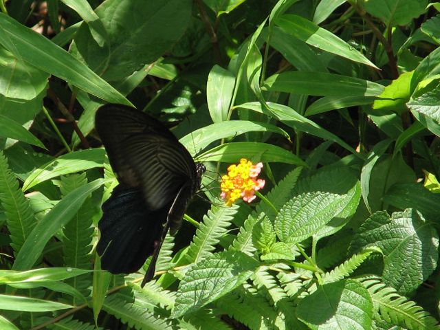 mult-modal trip. To change to Hongkong Island, use the Star Ferry. Next search and walk for the Base Station of the Peak Tram. No matter, if you choose to walk up the hill, or use the tram, both will be equally impressive. When I was there 35°C and a for me before unexperienced humidity pushed me into the tram. The tram rises about 400 m on 1.4 km with a maximum incline of 51%. Having jumped out of the tram at the peak station, pass a "somehow Bavarian mansion" (!) and follow the signs to Lugard Road. Lugard Road is an easy one-level walk around the peak, which offers great views into all directions, however, it's worth it to turn left
 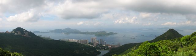 at the Bishop's Lodge towards the summit (150 more m of elevation). Be it on the summit or along Lugard Road, the peak seems to be the best place for butterflies to live, larger, more colourful, and more in number than anywhere else (I've been so far). Needless to say, that their number and colourfulness at the same time is in competition with the number and colourfulness of the
 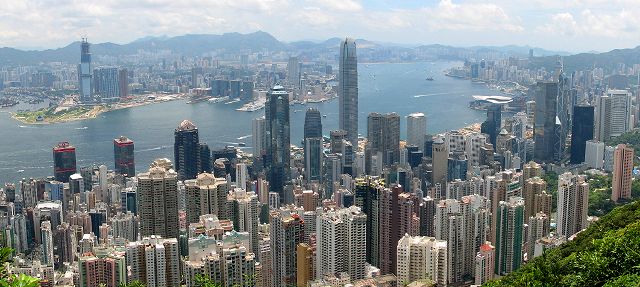 flowers of the peak. This appears especially improbable with all the monstrous densely packed skyscrapers below. Once the skyscrapers have gotten out of view one is looking southbound over the South China Sea with many small dark islands and steep shores - a different but evenly impressive view.
Clear view: 5/5
Nature: 5/5
Culture: 3/5
Chesapeake and Ohio Canal + Seneca Trail
The Chesapeake and Ohio Canal runs parallel 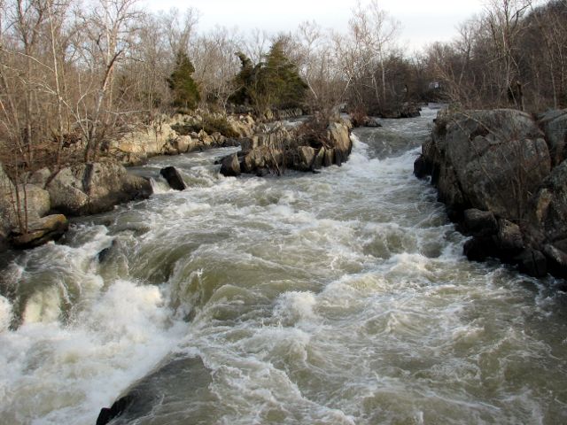 to the Potomac river. It was used to transport among other things coal from the mountains to Washington DC. It is out of service now for nearly a century and used as recreation area, partly with well kept parks, partly more left to its own. Between Potomac and canal the former towpath now is a convenient and flat hiking trail. Near the Great Falls (very impressive) of the Potomac there is the Billy Goat Trail, which is much more adventurous and arduous to walk than the towpath. These areas are a good place right outside Wasington DC to escape from modern day USA and get a glimpse of the history (many of the locks and lock houses still exist and tables sometimes tell stories that occured with them), of maybe not the first but still pioneering generations and simply get rid rid of the street traffic noise. Many residents of the region and even taxi drivers appear to not know of the Canal and the Great
  Falls, so one has to be carful to get the right taxi driver to take one there , as the main park is almost not connected to public transport, it's all a bit surprising for a European. Those people who do know the Falls, seem to know it very well. The Seneca creek is a left (northern) influent of the Potomac. While the Great Falls exist for there is a very rocky ground of the river, the Seneca creek runs through a very loamy soil, which results in it to flow calmly but in some areas winding much. The day when I was there was particularly interesting, as at noon, when I was walking along the Canal it was quite warm, more summer than spring, while along the shady Seneca still a lot of snow remained, especially on northern hillsides. In one snow field I almost sank in almost to the hips. Although there are "northern hillsides", the region is very flat and except for the Billy Goat Trail easily allows high walking speeds and so it is possible to do the 55 km in one day. And - honestly - along the Seneca for miles I wasn't tempted to let myself be delayed by taking a photograph. It was fine in this way, as I had to hurry a bit during the last few hours to manage to finish at dusk and not still be in the forrest in darkness.
Clear view: 3/5
Nature: 5/5
Culture: 4/5
Via degli Dei
The via degli dei ("way of gods") in five to ten legs leads from Bologna to Florence over the Appenin mountains. I did the tour in six days. Above for each leg there are given two distances. The first is the minimum distance, the second is what - roughly - I've been walking on that day according to my GPS device. The discrepancy stems from from time to time choosing the wrong way, having to go back, and second these are sight-seeing km at POIs along the track but mainly in the evening at the overnight stay villages and towns. The GPS tracks for download only include the minimum tracks.
From Bologna to Sasso Marconi
The first day is the only one to walk not on  mountains, but in the valley of the Reno river, at least after one has come down from Madonna di San Luca church to which an utmost comfortable arcade path (with 666 arcs) leads. Both, the arcades as well as the church are very impressive. That of all sections exactly these three km were roofed in this way, was about perfect, as these three km were the only ones at which it was raining a little. As I had read in a book on the via degli dei that the path along the river can be very muddy after rainfalls and as the days before it had been raining a lot, I chose to stay a bit more on the hillside on the via panoramica instead of using the official via degli dei trail. This was possible only to some point, where I had to go down to the river. At first it was tough to find any path at all. I had to force my way through dense coppice where from time to time it seemed that there was no path at all, or that the path had become a creek, forcing me to detour through even denser coppice. Without my GPS device I surely would have lost
  orientation completely (what a contrast compared to the arcades). Finally I managed to get back to the trail in the valley, where the GPS device told me that at least one group before me had been walking. However, now the muddiest part of the whole trail began: mud, that seemingly tried to grab my shoes, where I sank in to the ankles and poddles that extended all over the path, a number of times forcing me to detour through the coppice, often only finding back due to the GPS device. One time one leg was sunken in a poddle almost up to the hip. Partly I was not sure anymore, if I was walking along or inside of the river. Nevertheless, the two yellow dots marking the via degli dei could be seen from time to time at trees, telling that at least there probably won't be waiting some impassable obstacle ahead. Finally,
  shortly after having to drown my shoes once more in a creek feeding the Reno, I arrived on a road with obvious traces of vehicle traffic, promising that from now on to Sasso Marconi the quality of the trail would keep some minimum level. From now on walking was easy again and there was no need for special concentration, so it was possible to enjoy the Italian landscape that now, afterhaving left the river forest, was visible to both sides. Summer temperatures quickly dried water and blood on my legs and I decided to do the small side trip to Palazzo Rosso before heading for Sasso Marconi. Palazzo Rosso can be reached over a bridge which should make everyone understand, why there is a need for special HGV navigation devices, but that is just a note for the margins. It is currently under major renovation, but the restaurant is running and so I got a coffee. The final few km to Sasso Marconi lead along a major street (maybe there's an alternative?) with one part being particularly dangerous, as the street
  on a crest with only short sight is confined on both sides by a wall leaving no space for pedestrians. I chose to wait until no car could be heard and then actually ran to the top of the crest. Sasso Marconi seems to be the opposite of Bologna. While in Bologna everything is old and one asks, how long it can go on like this without major efforts for restauration, in Sasso Marconi except for a few buildings in the center, everything seems to be new. In the city center it was difficult to find an opened restaurant, only on the other side of the river, near the highway I was successful. Honestly, I didn't like Sasso Marconi much, but the way that restaurant prepared my dinner (inflaming the noodles in a caved wheel of cheese) was great.
Clear view: 3/5
Nature: 3/5
Culture: 5/5 (because of Bologna)
From Sasso Marconi to Monzuno
The second day begins with a steep path up  to a ridge from where the valleys to both sides can be greatly overlooked and towards Monte Mario. The path is that steep that one is glad that it leads along a fence that can assist in climbing frequently. The ridge at the top on the other side is even steeper, it's more a cliff than a hillside. This part of the trail ato me ppears impassable for people with acrophobia. Although the flanks of the hill give a direction, it's difficult to keep the orientation in that area. Again I was glad to have a GPS device with me. Even with that it was difficult, as at one point the intended track was just 30 m away, but on the bee line there was a cliff. Finally I managed to get back on the track and from there made quick progress. After some time the path steeply
 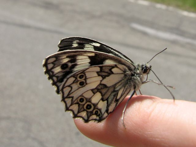 leads down again to a main street, just to almost immediately rise steeply along the slope of La Roca, which is not so high, but steeeep. The small village of Barolo is a good opportunity for a rest, however, when I was there, no restaurant or cafe was opened. After Barolo one once more has to climb a number of meters, which in this case is rewarded by brilliant clear views. After Badolo has gotten out of sight the next intermediate destination is Monte Adone, one of the patrons of the Via degli Dei. Before one reaches the summit, one has to pass by some column like shaped rocks. The view from Monte Adone is the best of the day. The path down from Monte Adone directly leads to Brento, a not-so-small town, where it is guaranteed that one can get a lunch. The path out of Brento actually is a road, wh
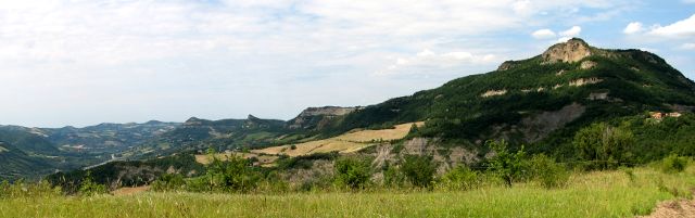 ere it happened that right in front of my eyes a butterfly got into the suck of a car heeding by. There it laie on the upper side of its wings and couldn't help itself. I lended it my little finger, which it grabbed and gratefully it allowed me to do some pics. It seemed it didn't want to release anymore, so I had to strip it to some leaf, where it preferred to hang on the downside. Honestly I fear that after some time it fell off and fed the ants on the ground, but I had to continue. What is worth mentioning on the remaining easy to walk way to Monzuno are some fower-rich meadows. Monzuno itself has everything one needs, but - except for the view on the surrounding countryside - is unspectacular.
Clear view: 5/5
Nature: 5/5
Culture: 2/5
From Monzuno to the Passo della Futa
Shortly after having left Monzuno early in the 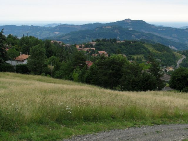 morning one has to go... - right - uphill. Before the path leads into a forest a look back shows the entire way made so far: Monzuno and Monte Adone in the hills of Emilia-Romagna with Madonna dei San Luca residing on the seemingly farthest one and hidden by it and the haze Bologna. Once the forest opens again a view on a range of higher hills opens and from there an easy, paved road with a march of one and a half hour leads along flowerous meadows to
  Madonna dei Fornelli and by that a second breakfast. On the way one crosses a park of strangely asymmetric modern wind mills. The way out of Madonna dei Fornelli step by step seems to lead to ever more remote lands and consequently to a very lonely lunch break at noon. One after one houses re-appear and after Pian di Balestra at the (along this trail) first occurence of the Via Flamina one crosses the border to Tuscany and enters another lonely part of the trail; a lonely and - even
  after three dry days - muddy part. In the mud I'm still thinking of one of the many animal traces to have been one of a wolf, but I'm not sure, it was smeared and the pic I took was even more blurred. After the mud and at a small lake the ascent to the highest spot of the whole tour along il passeggere begins. One only scratches the 1200 m, but it was cold up there, especially compared to the following days. If one thinks that the remaining and descending five km are a cakewalk one errs. Indeed it's going down, and indeed nowhere really steep, but all the time over a rough, rocky path. I had to rest one time not because of physical exhaustion, but because of the permanent need to concentrate on every step. Here a
  number of remains of the Via Flamina are left. And in this area - although the incline of the hill should suggest the correct direction - there again are number of chances to walk astray. Again the GPS device has proven to be very helpful. Finally right before the German Military Cemetary with the remains of more then 30,000 German soldiers one leaves the forest and quickly arrives at either the hotel or the camping site of the pass.
Clear view: 4/5
Nature: 4/5
Culture: 3/5
From the Passo della Futa to Sant' Agata
In the way I segmented the Via degli Dei,
![]() this is by far the shortest leg - and it is the loneliest. Along all the way I just met one group of two men and a dog. Finally summer had superseded spring. Maybe it was that why - that it was really warm compared to the weeks before - that in spite of the small number of km this was the evening when I felt most exhausted. The summer weather also had another effect. It seemed that all of the nature to the left and the right of the path got livelier. Each few seconds I heard the rustling of something fleeing from my feet into the deeper grass. Although it probably always were some smaller lizards (compared to Central European ones, they're quite big, though) especially chameleons, this always remembered me that where these feel comfortable vipers do as wel
this is by far the shortest leg - and it is the loneliest. Along all the way I just met one group of two men and a dog. Finally summer had superseded spring. Maybe it was that why - that it was really warm compared to the weeks before - that in spite of the small number of km this was the evening when I felt most exhausted. The summer weather also had another effect. It seemed that all of the nature to the left and the right of the path got livelier. Each few seconds I heard the rustling of something fleeing from my feet into the deeper grass. Although it probably always were some smaller lizards (compared to Central European ones, they're quite big, though) especially chameleons, this always remembered me that where these feel comfortable vipers do as wel l. I understood very well that the chance to carry away a permanent damage by a snakebite was even much smaller than injuring seriously by falling after not having paid attention of where to step, but I think the standard medical procedures alone after a snakebite wuld have meant the end for the tour, so for this and the two following days I was highly alert, when there was a tock-grass-little branches-melange forming the path in the sun. For the view Monte Gazzaro offers the 200 m of elevation from Passo della Futa are a small price. While these were rather comfortable to walk, the
  next few km, where one would lose half of them again, took some effort. After the Osteria Bruciata (the "burned down restaurant" - burned for -as it is said - its owners feeding their guests with the guests of the day before) far away of anything to call a neighbor bizarrly in the forest there is a overgrown ruin. Of all overgrown ruins on this trail, this one appeared to be most mystic - and mysterious, as it seems that it must have been odd at any times to take the effort of building a house right here. Not much later one starts to descend to Sant' Agata. The way down, however, partly is nothing but a dried creek. There must by times, when it's not dry. Luckily that was not that day, but still it was difficult enough to balance over all these little rocks. Suddenly one leaves the forest and from there on for the last two or three km walks through blooming bushes and flowers and where they give free the sight it is a typical Tuscany one.
Clear view: 4/5
Nature: 4/5
Culture: 3/5
From Sant' Agata to Bivigliano
This day has two parts: the first is an easy  walk along the street to San Piero al Sieve. The street is not much frequented, but those cars which drive there do not slow down ahead of unclear turns but blow the horn to give the wanderer half a second to jump into the safety of the adjacent field. The street is a bit elevated from the surrounding plain, which all of the time allows a good view into all directions. San Piero al Sieve is a nice small town, which is reached after about two hours and therefore just in time for a second breakfast. The second part of the day begins right after San Piero. Each step that leads up the hill at the same time leads into very lonely area. Shortly after the last house something was rumbling in the coppice
 right next to the way for some seconds until a young deer suddenly was jumping onto the way. He seemed to be as surprised about me as I was about him so that - at least I assume that it was confusion that made him do so - at first he was heading straight towards me. Only when I clapped into the hands he turned to the right and with a forceful hop jumped over the coppice on the other side of the way. Luckily I had the right intuition to clap the hands, as if the deer had crashed into me it probably had have bad effects for both of us, although he was smaller than me and his antlers only basically developed. The path here always leads directly to the south, always along a ridge (but not a narrow one) often
  with a view to the western valley and all the time upwards. Along the way there's the ancient monastery Badia del Buonsollazo, which is a ruin. It's locked and used to keep goats. From there to Monte Senario it's still 200 m to climb. The path here is narrow but widens the more one closes in to Monte Senario. Finally one arrives at Monte Senario, formerly the refuge and soon convent of the founders of the Servite Order. Virtually any piece of art in the church of the convent depicts the founders following a vita contemplativa or promotes this ideal. Much ora, few labora. Compared to this variant of catholicism even a part of German catholic clergy appear Protestant. However,
  obviously someone has made the effort to build the impressive building complex that takes some time until it is explored. It seems that the closest opportunity to stay overnight is in Bivigliano, which lies half-way down Monte Senario. On the way down one passes villa by villa. It seems that this already is part of the commuter belt - a very affluent part - of Florence.
Clear view: 4/5
Nature: 4/5
Culture: 4/5
From Bivigliano to Firenze
As I wanted to  avoid to have to go back up to Monte Senario only to descend again on the ridge, I followed the main street out of Bivigliano, knowing that I had to climb a short piece of hill at some point. That piece showed up to be a narrow, overgrown bridleway. Luckily no horse was on it at that time. A few meters after the ridge I knew that now it should be possible to see Florence and the dome again, but it was hardly visible. Soon after - as for a number of times on his day - the path led through pine groves a number of times. Also concerning flowers this day probably was the richest one, Tuscany really showed itself to be different than Emilia Romagna. On the way to poggio pratone yellow wwas the
 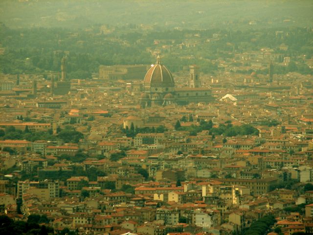 dominating color, the vegetation once more was about to conquer the path and walking time estimations on the signs were optimistic. I had underestimated the effort to reach this hill, but from there on going down to Fiesole went quicker, although along a street with uncomfortably few space for pedestrians (namely none). In the ten year old book I had with me on the Via degli Dei Fiesole is still described as "sleepy". In that case things have changed meanwhile. Just a minute ago still in wilderness, now overrun by a surge of a melange of pushy Italian car drivers and German or American tourist groups risking a well dosed number of steps outside their cars and busses, whereby the good thing about Italians is
  that I would not understand if they are talking nonsense, which regretaly is different with Germans and Americans and after that week "outside" a number of times in Fiesole ached unpleasently in my ears. Still, Fiesole is worth to spend some time there (also for the view over Florence) and I would have done so more, if not Florence had been my destination. Maybe it was a mistake to have Fiesole planned just as a short rest. Now there would have been the chacne to walk a major street directly to Florence, but - probably as most people would decide to do - I chose to detour along the North Eastern Hillside and Maiano, which quickly becomes surprisingly rural again. Maiano was a good chance for a good lunch for a normal price from which it's just about one km along an Olive grove to the first houses of Florence. On the way to the center Florence gradually changes from a normal city to the tourism capital of the world. As I knew Florence only from a visit in
 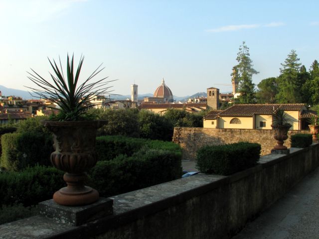 November - which brought me to the idea of doing a tour like this one - I was really surprised about how massive international tourists dominate the city center in summer. If it's just for Florence alone - or maybe even for its museums - go there in winter time. If it needs to be summer, go there on the day of the festival, which I occasionally had run into. I was visiting the Boboli gardens, which I had missed then, and when I left I saw preparations of music bands for performances obviously to come that evening. And in deed the whole part of the city left to the Arno was a party zone that evening. I felt that I had walked
 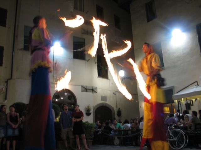 enough and chose to stay most of the time at the Piazza dell Passera, where a band played medieval music (serious one) and taking turns with two jugglers/artists. These were passing lit torches while balancing on stilts inmidst of a circle of audience. And who happened to sit in the elongated line of the flying torches? Right, me. Next day I went back home. The decision not to fly but to go by train was a very good one as by this for the first time I made the impressive trip over Gotthard and that on a day with very good weather.
Clear view: 3/5
Nature: 4/5
Culture: 6/5
Boucle de Quiberon
This is a loop trail on the breton peninsula of  Quiberon, predominantely leading around the village of the same name. Quiberon formerly was and still is almost an island. At its narrowest point North the connection to the main land is just 200 meters wide, one road and one rail line pass through that connection. Quiberon extends roughly in north-south direction, thus it has one coast facing to the main land and one to the sea. This trail passes by both of them as well as the most elevated spot of the peninsula – decorated with some tower – and the main touristic sand beach in the south. We begin at Port Haliguen on Quiberon's eastern coast. Northbound we first walk along the shore,
  but leave it soon onto a narrow path through dense vegetation. A passage through settlement follows. Houses on Quiberon are typically white with narrow windows. After having passed the central road of Quiberon we are going slightly uphill through a green environment toward the central axis of the peninsula. From the tower at the highest spot one can overlook nearly the entire peninsula. Then – downhill again – we pass Kerniscob, a small hamlet, and reach the western coast called côte sauvage. And indeed, contrary to the eastern and southern shores the western coast is rocky has higher waves and is generally not suitable for bathing, but visually it makes a more interesting impression. Along the coast cars,
  cyclists, and pedestrians are guided on – most of the time – entirely separate tracks. After some time we reach again the main settlement of Quiberon, first Château Turpault which marks something like the south-western corner of Quiberon. From Port Maria on we are in what typically is the most lively area of Quiberon with the main beach and the casino, particularly during vacation times. Finally we give the south-eastern tip of Quiberon a visit, where Quiberon appears to reach for the Île d'Houat and where it is not clear what is sea and what is land. Passing Fort Neuf we return to Port Haliguen.
Clear view: 3/5
Nature: 4/5
Culture: 3/5
From Le Palais to Sauzon
The Belle-Île-en-Mer is an island at the  southern Breton coast. It is not connected with a bridge to the main land, so there is only the chance to go there with a ferry or fly there. The main harbor is in the village of Le Palais, where our tour begins. Already on the boat a huge fortress falls to the eye and does so even more once one has arrived. In its current form it has been constructed by – guess who – Vauban. Our start is delayed as in the harbor we have to wait for a small pedestrian drawbridge to come down again. I love pedestrian drawbridges, as they create experiment type of situations having two large groups meet on a small space. So, once I had packed away may camera, making it over the drawbridge right before it went up again, we could actually begin with our tour, first ascending up to the citadel. Passing through it we realize that it really is impressive, its enormous extent coming close to the one of the housing area of Le Palais itself. It is the
 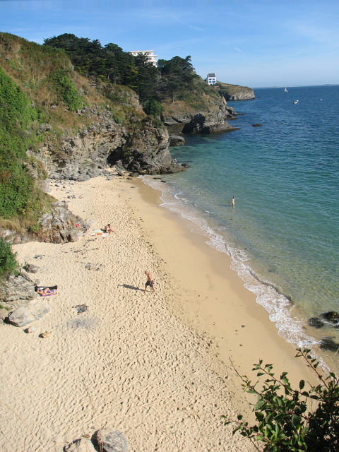 islands geology which gave it its name. Not, because the rocks have a particularly nice color, but because their consistency in permanent struggle with the sea has led to the formation of an abundance of beautiful bays and a number of nice sand beaches. The vegetation partly has a Mediterranean appearance and the few houses standing around individually are in very good shape and qualify as adornments of the landscape. The pathway is usually a very narrow single trail, such that one has the impression to be forced to walk on a line or with the two feet on different level or uneven surface, both of which can be arduous after some time. It's also hardly possible to overtake larger, slower groups which means that your estimation of how long the tour will take you may be futile. Although we are more or less walking along the coastline we are more or less always either going up or down and consequently the map device at the end of the day shows no less than 521 meters as sum for the altitude difference.
 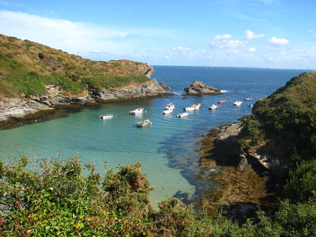 Thus, while this tour surely is not difficult, don't let yourself be fooled by a first estimation looking on a map. At Pointe de Taillefer there is another fort, or better: its remains. Fort Taillefer is by far not in as good a shape as the citadel of Le Palais. Our destination is the village of Sauzon, where we later catch a bus back to Le Palais. Sauzon is a small, but really pretty village. We end our investigation of the Belle-Île here, but the official hiking trail leads around the entire island.
Clear view: 3/5
Nature: 4/5
Culture: 3/5
Round Trip at Carnac
Since this is a round trip it is irrelevant where  to start. We have begun at Plouharnel a city or village with a nice bretonic core and church. Leaving Plouharnel eastbound on the Rue de Pen Erlé we are heading directly towards the Abbaye Saint-Michel de Kergonan, a monastery in good shape and with a wealth of flowers. Afterwards the trail forces us back to the main road between Plouharnel and Carnac (Karnag) and meets it about 500 m before Carnac which means that there are 500 ugly meters along the main road to be done. Passing the north-western-most houses of Carnac we immediately reach the famous standing stones of Carnac, to be precise: the western end of the in total more than three km long field (nowadays; originally it extended over 8 km). Inevitably one wonders how people 5,000 years ago were able to do so, how they managed to do so (for no matter how it was done operationally, this surely was the joint work of a group of people). Even more interesting for me personally would be to learn why they did this? What was it that
 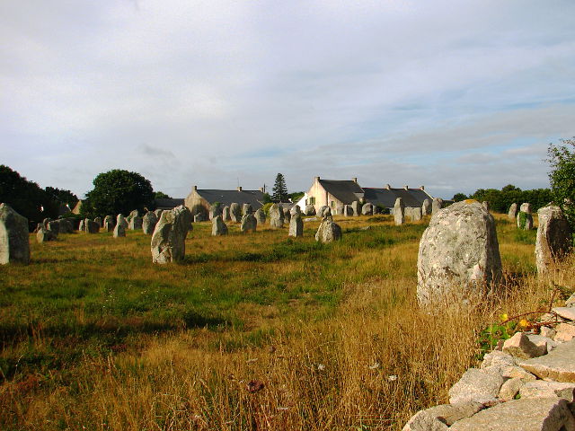 could motivate people to take this arduous effort? We follow the Ménec alignment to the Kermario alignment inmidst which we turn right, passing through it and again right afterwards. At the western end of the Kermario alignment we turn left. The next destination along the way is the Fontaine Saint-Michel Michel before at the edge of Carnac we pass the Tumulus Saint-Michel. Just a few steps further modern Carnac welcomes us back with a wide road. We pass and visit the city center changing from eastern to western side of the city. Along a suburbian road we eventually reach the sea side. This part of the shore is mainly used for oyster production. Unlikely someone would spend a day at the beach here. Passing Kerhellec and Kercroc we return to Plouharnel.
Clear view: 1/5
Nature: 3/5
Culture: 5/5
Ile de Ré
This tour along the northern coast of Ile de  Ré from La Couarde-sur-Mer to La Flotte offers lots of marvelous perspectives. However, as the landscape is flat and open with only few vegetation growing higher than six-foot it can well be done by bike without missing anything. Probably all paths of the island can be cycled and – at least outside the villages – everything which comes into view at some time is seen already from hundreds of meters away. Thus as a pedestrian one develops a feeling of moving really slow, not to speak of the permanent presence of cyclists moving into all directions which becomes annoying after some time (obviously the first mentioned experience is
  shared by many people). So the tour cannot really be recommended as a hiking tour, but as a cycling tour. Still in the villages it is advisable to get off the bike, spend some time and discover them by foot. The starting point of the track is a bus station somewhere in nowhere. For the first kilometers we are passing saltern ponds and canals connecting and supplying them. As soon as we reach the shore we see the second business of the islanders: oysters. And all along the way elements of the third business: tourists, which is no wonder; the pictures embedded in this text are just a small sample of presentables. Saint-Martin-de-Ré in its entirety is one of the many forts built by Vauban. The stonework is preserved well and gives
  an impression that a former main business of the islanders was (defensive) war. Btw.: in Bing maps the center of the citadel is (still?) blurred. Are the French still concerned about a possible attack of the English fleet or is it to preserve secrets of tourism business? And why then is it shown without restrictions in Google maps and only half the area blurred in Here? It is possible to climb the tower of the church in Saint-Martin. The space for climbing in the tower is so narrow that the movement direction is regulated with traffic lights and the stairs and ladders are shaped by a norm unknown to me which together makes the way up a small adventure. However,
  the view over the village and to the harbor is worth it. Once the light maybe eventually turns green for going down after some or some more time its time to go to the harbor where people enjoy life in many bars and cafes – as many as a village of this size can host and as long as there are not too many people willing to enjoy life, which may spoil the plan for all of them. We leave Saint-Martin and proceed at the coastline to La Flotte and spend some time at the small beach next to the citadel for it will just take around 30 more minutes to La Flotte. La Flotte welcomes visitors with a promenade extending to its western edge. It is not exactly as picturesque as Saint-Martin but still definitely worth a visit.
Clear view: 2/5
Nature: 3/5
Culture: 4/5
Ahrweiler Alte Mauer
This track I have prepared and done as a running circuit and not as a hiking tour. Therefore there are no pictures. Start and end point is a bus stop above Ahrweiler. The motivation and destination of the tour is the Alte Mauer, the remnants of a Celtic refuge located on top of a hill of volcanic offspring. The first four kilometers are uphill (230 m) followed by 5.5 km downhill (in the valley of the Wingsbach) with decline up to 20%. So, good shoes are required. The way back to the starting point through the vineyards offers a view over all of Bad Neuenahr-Ahrweiler.
Clear view: 3/5
Nature: 3/5
Culture: 3/5
La Gomera: Agulo
Agulo is situated on a plateau, elevated 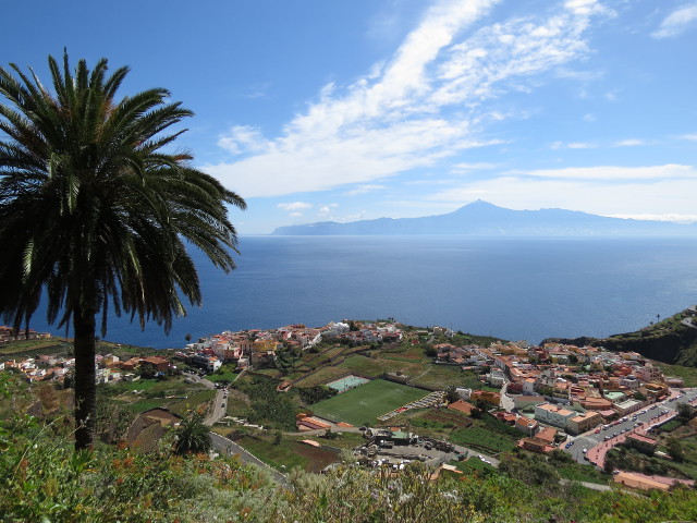 about 200 m above the sea level at the north-eastern coast of La Gomera. It is „just around the corner“ of Hermigua at the main island road to Vallehermoso. The corner can be understood in the sense of the word as a ridge comes close to the shore and leaves only few space for the road. Agulo is at the end point of a valley and that valley is today our destination. While Agulo rests on a flat plateau, directly on its back side the valley is very steep. Having crossed the road the first 500 m of the trail rise by more than 200 m. All along the way and also often later the day
 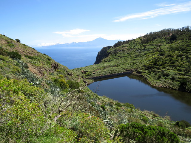 one has a fabulous view on Mount Teide. Kind of suddenly the path turns right and flattens. More than 300 m above Agulo a small barrier lake probably is or at least was an important guarantee of fresh water for the people of Agulo. The view over that lake and then the sea to Teide is just great. At the end of the lake there is a small vacation settlement. There we turn sharply right and do not follow the valley furthermore. Instead we head for the Mirador de Abrante, the place with arguably the best view on Agulo and Teide. A skywalk and facilities to possibly house a café there have been built, yet as we were there everything was closed. Around Abrante
 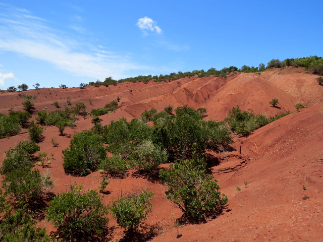 the landscape looks different. The soil is red and dusty. It looks like after 100 years of terraforming attempts on Mars. From Abrante our next destination is the island's visitors center Juego de Bolas. On the way there aloe vera frames the path in an abundance which is even remarkable for La Gomera. Having seen only relatively few people on the trail so far the liveliness of Juego de Bolas might be surprising, but the visitors' center is one of the points of interest most day tourists from Teneriffa visit. Juego de Bolas is the top of our today's tour. It is situated 550 m above Agulo and we have reached it via just 5 km and those were zig-zagging. After a coffee we turn back towards Agulo, first on the same way as we have come, later in a neighboring valley north-west of Agulo.
Clear view: 5/5
Nature: 4/5
Culture: 2/5
La Gomera: Vallehermoso
Vallehermoso is the second largest community of La Gomera situated at the Northern part of the island. While the community and the valley Vallehermoso extend to the sea from the village itself it is about 4 km to the shore. We set out from the main parking lot on the Calle Mayor and turn left onto a narrow stairway street and by that some time later enter the the Valley of the Barranco de  la Era Nueva. West of Vallehermoso a number of valleys extend in west-east direction and all of them are confined in on their western side by a major ridge which can easily be spotted on a map from Garajonay (La Gomera's highest mountain) to the sea. For three km – as long as we are heading westbound – the path by and by rises steeper and by and by gets narrower as the vegetation closes in more and more. At first and as long as Vallehermoso can still be seen a wide path leads by small farms and gardens with – among other plants – papaya trees. At the end of the valley the path turns right and to climb the main ridge we have to master the steepest piece of today (30% incline) and shortly afterwards with 764 m the very windy and for that reason even a bit cold roof of today's tour. After that for nearly one km
  the path is nearly flat on the eastern flank of the ridge. Where the path crosses the ridge to continue on the western flank a small rest place has been installed. We rest there and enjoy the fascinating view over the north-western shore, the sea to La Palma that opens here. The next three km are easy: slightly downhill on a comfortable path; through sometimes sandy areas and always with a clear view on the sea. Somewhere there is a single building (a chapel?) aside an astonishingly symmetric and regular type of tree. Close by the sands mark the Spanish flag on the ground. This appears to be no artefact as just a few meters further one can arguably recognize also the German flag. For us this area appears to be very remote, but the terraces tell that it has been used intensely for agriculture in the past. At the northernmost point of the tour we are 600 m away from the sea, but still more than 500 m
  above it. And exactly there we pass another terrain transition: we leave the ridge and that consequently change from gently to steeply downhill. 2 km later we stand on the shore of the Atlantic, having had a good view all of the time on the valley of Vallehermoso and – due to the ever changing elevation – each 5 minutes the same landscape has looked different. The steepest passages were well above 40% and everyone who came across looked pretty exerted. The shore of Vallehermoso – at least its flat part – is really nice. The community has placed its open air pool there such that people do not depend on the state of the sea or generally do not have to face its risks while at the same time fell almost like swimming in the sea. The kiosk and everything it offers is welcomed a lot by us. What remains is to go back through the valley to Vallehermoso and our car. The valley is mainly used for agriculture; many nice and interesting flowers, agriculture plants, and animals frame the way.
Clear view: 5/5
Nature: 4/5
Culture: 2/5
Valle Gran Rey
The Valle Gran Rey stretches – about from  the center of La Gomera - in southwestern direction. It is a relatively large community on La Gomera and together with San Sebastian the most lively and touristy one. The more or less continuous settlement stretches from the shore 4 km upcountry. We begin at the upper end of the settlement, at the bus stop in Lomo del Balo, a place from where one has a marvellous view over the valley to the sea. We first pass through the village where we enter the hillside, first on a cobbled way
 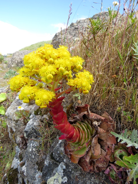 which gradually changes to a trail which first leads straight uphill then changes and leads for about 2.5 km along the mountain side with spectacular views into a groundless precipice to the left and a steep flank to the right. Just before we reach El Cercado the terrain flattens (in all directions). El Cercado is a hamlet elevated 1000 m above sea level. People here have focused on manufacturing traditional ceramics. Nearly at every house a sign praises such products of the house owner. (Global?) division of labour obviously has reached El Cercado before us. On the opposite side of the same ridge along which we ascended we now descend back towards the sea side again. In the vicinity of El Cercado the terrain is flat enough that with terraces formerly agriculture was possible. The terraces and the vegetation give the area a
 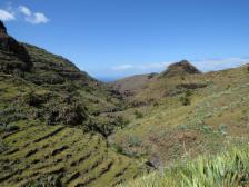 special atmosphere. A small creek has carved itself into the rocks and soon we can again see the sea. As we are in the neighbouring valley of Valle Gran Rey we have to cross the ridge between the two once more and do so at a kind of natural rock gate with a great view over both valleys. Soon after that point the trail descends steeply to the valley. The remaining two km along the valley channel are at first pleasant on a foot path, but regrettably end up parallel to the main road.
Clear view: 5/5
Nature: 4/5
Culture: 2/5
La Gomera: Garajonay to Hermigua
Garajonay is – less than 10 km away from the 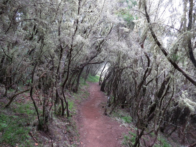 coast – the 1468 m high peak of La Gomera, national park, and world heritage site. The simple plan for today is that we let ourselves bring with a cab to the peak and then walk back to our lodging in Hermigua, so the easy way downhill. The opposite direction would of course also be attractive, but it seemed especially easier to us to order a cab in the morning in Hermigua instead of calling one in the afternoon and near the peak. Hermigua is northwest of Garajonay, i.e. on the wet/foggy side of the island. The creek in the valley of Hermigua (Rio del Cedro) is the
  only creek of La Gomera which (usually) carries water year-round. A good starting point for the tour is a roundabout (Pajarito) near the peak where roads from all directions of the island meet. From there its about 1 km to the peak, partly through forest area which was affected by the big fire some years ago. If it is not cloaked in a cloud, the view from the peak is absolutely impressive. The way back to the road towards the entrance of the valley of Hermigua has been very well developed, obviously it is thought off as part of the day tourists from Teneriffa who have just a few hours available on La Gomera. Where this foot path crosses the road there
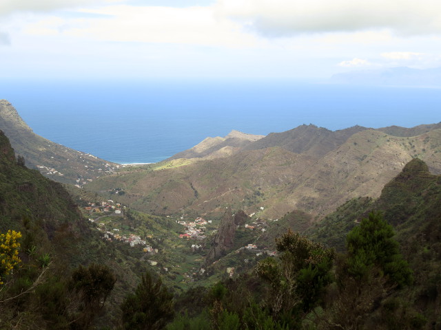 is also a parking space (El Contedero) and if you want to skip the peak and shorten the tour here would be the starting point. Immediately the forest is of the typical La Gomerian cloud forest type, dense and dark. The Ermita Nuestra Senora de Lourdes is a chapel along the way (after a total of about 6 km) around which a number of benches and tables have been installed. It is the first good opportunity for a rest. In a way it is also the last bad opportunity to do a rest as – at least
 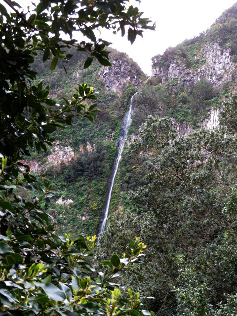 at the day we were there – the place was explicitly cold and just a few meters further it was/is clearly warmer. If good or bad as a place so many hikers rest, eat and drink here that from what they leave over a considerable population of birds (wild canaries?) can live from and have lost all awe from men. Along the next two km vegetation and landscape change. The valley is wider and the cloud forest opens; to be precise it is now a different kind of forest. With La Vista we reach the first house of Hermigua. As it is a restaurant this is the second good chance for a break; this time in the sun. That it is the first house of Hermigua does not mean that the rest of the way is unspectacular or that from now on one walks within the settlement. On the contrary: the next passage is very steep and from it one has a great view to El Chorro the
 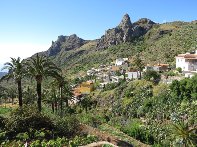 highest waterfall of Gomera (~100m). At a small barrier lake we have reached about the hight of the tip of the Roques de San Pedro – Hermigua's landmark. Soon thereafter a goat with an impressive corkscrew horn blocks the way. That normally is something very temporary. Still, that goat looked very pride and very resolute to stay there for one or two centuries that it appears to make sense to mention it here. Nevertheless: when we closed in he was very cooperative and gave way. Having passed that guardian the indications of civilization get more frequent. More and more houses, more and more agriculture, more pets. The GPS track ends at our lodging. The cab stand of Hermigua is just further down the road in the center of Hermigua.
Clear view: 4/5
Nature: 5/5
Culture: 2/5
La Gomera: Imada
Imada is a remote village on and kind of south  balcony of La Gomera just outside the national park. It is our starting and end point. Near Imada the canyon is comparatively wide and flat. Once it gets more narrow and steeper it is called barranco de Guarimiar. The barranco has steep rock walls on both sides, palm trees growing in the narrow thalweg and occasionally a pool along the otherwise apparently more or less dried-out creek. Maybe unique for La Gomera is a narrow channel running approximately along the path on the western side of the valley.
 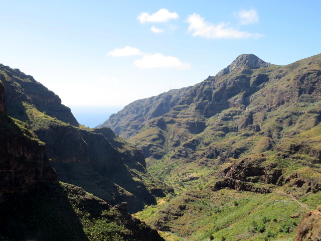 It must have been proverbially a Sisyphean task to keep this channel free of rocks and blockages. It appears that until recently someone has taken care for the channel as for most parts there are only astonishingly few stones inside the channel. The channel supplied a hamlet further down the valley. Very soon after that hamlet we leave the valley and follow a small path up the western side of the valley towards Targa. Reaching the upper edge of the barranco and with it Targa the impression that this area is remote and
  wild is immediately gone. The valley quickly gets out of view and the landscape appears rather flat, houses are new and the streets wide. Later we have to follow for 4 km one of the wide roads. For this reason it is a good idea to search for a different way back to Imada. Then, however, the final few km are again fine.
Clear view: 4/5
Nature: 4/5
Culture: 2/5
La Gomera: Playa de La Caleta
This is a double loop through and from  Hermigua to its beach and – at least what we believe is – its first-idea day-trip destination. The starting point in Hermigua is more or less arbitrary, in the track one of the roundabouts not far from the cab stand is chosen. First we follow down the Carretera General Norte (it is probably safe to say that it is the center of Hermigua's social life) and at the petrol station turn right down some
 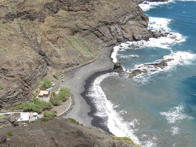 stairs into the cooking plantain plantage. Here and as well on the opposite side of the valley we found some marvellous flowers. Once we have nearly reached the beach we have to rise steeply the south-eastern side of the valley of Hermigua to reach the crossing where the two loops of this tour meet. From there one has a fantastic view back on the valley of Hermigua with its sparse, extended but still continuous settlement from the sea to the settlement of Callejón de Ordaiz (due to the curvature of the valley of Monteforte the highest situated settlements of Hermigua cannot be seen). The next one or two km are on an unpaved road; interesting views, but unspectacular, not the highlight of the day. This changes once the path leads steeply
  downhill once more and we reach a hamlet in a small canyon. The creek, the rocks, and the vegetation (and potentially the shadow on a hot day) make it an oasis and a perfect opportunity for a rest. The opposite side of the canyon is even steeper than the side by which we entered and so we quickly reach the highest point of today where we reach back to the road. Passing by some ruins of a former farm or even small industrial site we reach El Palmar which has as well been given up. We figure out that it is still housed by at least one fat gekko – La Gomera's mascot. El Palmar is the most remote point on this tour so now we turn back and by that turn to La Caleta (of course there would also have been a more direct way). The beach of la Caleta is really a place to forget about time. The sea gives an appeasing background sound, the sun takes care that it doesn't get cold and the wind that it does not get hot. A bar
 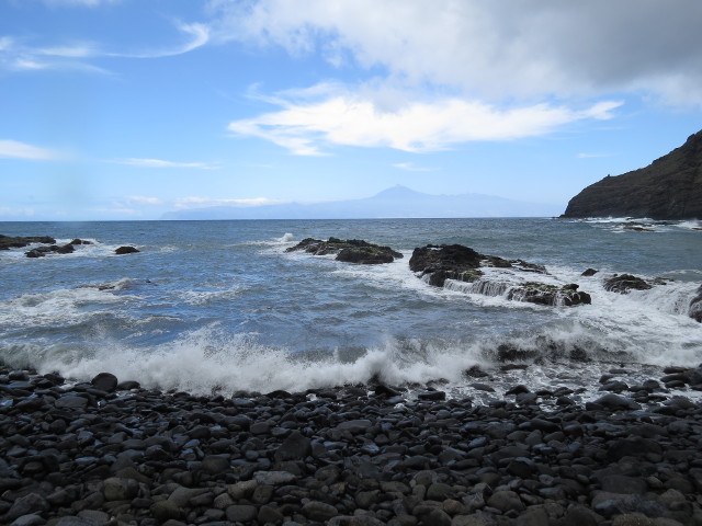 (which in the evenings appears to also act as an open air restaurant) offers most of what people desire through the day. And all of that on a stage set by Teide in the background. In principle bathing is possible, just at the day we were there water and wind both were a little too lively so that not many people dared to really swim. On the way back (already in Hermigua) we pass by an open air exercising parcours and a sign warning in German language “Sonnenbrand gefährdeter Bezirk”. The long arm of Brussels' law?
Clear view: 4/5
Nature: 4/5
Culture: 2/5